Purpose of the flight and payload description

Is a modified version of the LPMA instrument (Limb Profile Monitor of the Atmosphere originally created to made Earth's limb measurements) used to observe the Earth's atmospheric emission at nadir, to determine the vertical profiles of various atmospheric gases such as H2O, CO2, CO, O3, N2O, & CH4 from high resolution atmospheric spectra. Their major goal is the preparation of the so called IASI mission, which is a satellite instrument dedicated primarily to operational meteorology, hence it is also known as IASI-balloon.
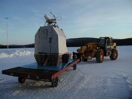
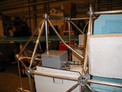
The instrument is composed by a BOMEM DA2 infrared Fourier transform spectrometer coupled with a movable mirror. An optical head with an aquisition mirror looks down and made the nadir observation while two references blackbodies one warm and the other cool are used for reference purposes. A CCD camera is used to image in the visible the atmosphere observed by the spectrometer and to make corrections in the instrument attitude commanding the aquisition mirror. The instrument is installed in the same gondola developed by the CNRS for the LPMA instrument, wich have an azimuth control system to compensate the balloon motion. An onboard PC computer controls the instruments during the flights, recording the interferograms and ensuring the telecommand and telemtry link with the ground station.
Details of the balloon flight
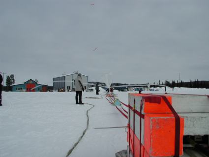
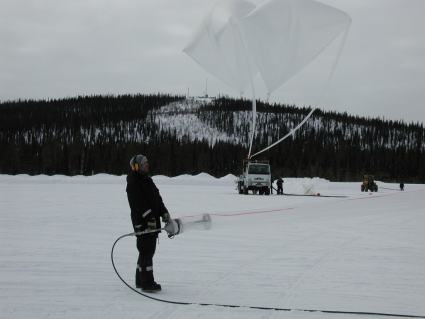
Balloon launched on: 3/13/2001 at 10:26
Launch site: European Space Range, Kiruna, Sweden
Balloon launched by: Centre National d'Etudes Spatiales (CNES)
Balloon manufacturer/size/composition: Zero Pressure Balloon model 100z 100.000 m3
Balloon serial number: 100Z Nº 113
End of flight (L for landing time, W for last contact, otherwise termination time): 3/13/2001 at ~ 13:50
Balloon flight duration (F: time at float only, otherwise total flight time in d:days / h:hours or m:minutes - ): 4 h
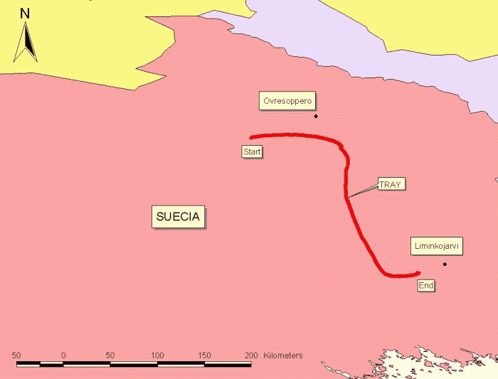
Landing site: 25 km at W of Liminkojarvi city, Sweden.
Campaign: ARCHEOPS
Payload weight: 716 kgs
Gondola weight: 456 kgs
The balloon was launched at 10:26 utc on March 13, 2001 using the auxiliary balloon method.
After and ascent phase of near one hour and a half, the balloon reached float altitude at 31.3 km and started an southeast path during 2 hours and 20 minutes as can be seen in the map at left (click to enlarge). The flight endured until 14:20 utc when the separation command was transmited. The payload landed 25 km west of the city of Liminkojarvi in Sweden.
This was the first flight of the instrument and was performed in the Arctic winter in rather cold conditions above a low cloud deck with some clearings down to the surface covered by snow. Near 200 measurements spectra were obtained.
External references
- LPMA project website Laboratoire de Physique Moléculaire pour l'Atmosph&eagrave;re et l'Astrophysique (via Archive.Org)
- CNES / Nacelles Pointees
- ENVISAT Validation Results Obtained with LPMA and IASI-Balloon FTIR 2nd Workshop on the Atmospheric Chemistry Validation of ENVISAT, 2004
- List of balloons launched from ESRANGE SSC Space website (via Archive.Org)
- Results obtained during recent flights of the LPMAA balloon experiment and contribution to the ENVISAT validation 17th ESA Symposium on European Rocket and Balloon Programmes and Related Research, 30 May - 2 June 2005, Sandefjord, Norway
- Stratospheric balloon measurement (Limb Profile Monitor of the Atmosphere) SSC Press release
Images of the mission

If you consider this website interesting or useful, you can help me to keep it up and running with a small donation to cover the operational costs. Just the equivalent of the price of a cup of coffee helps a lot.
