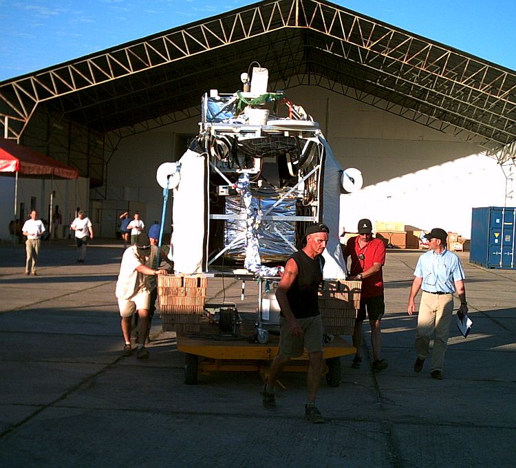
Purpose of the flight and payload description
It is an advanced Fourier Transform Infra Red (FTIR) spectrometer specially tailored to the operation on a stratospheric balloon gondola. It allows precise limb emission sounding of chemical constituents related to the stratospheric ozone problem and the greenhouse effect. This method is appropriate to obtain vertical profiles of ozone and a considerable number of key radicals (NO, NO2), reservoir species (HNO3, N2O5, ClONO2, and HO2NO2) as well as source gases (CH4, N2O, H2O, CFC-11, CFC-12, CFC-22, CCl4, CF4, C2H6, and SF6) simultaneously, with an altitude resolution of 2 to 3 km.
The MIPAS-B experiment was also thought as precursor for a space version of MIPAS actually installed onboard ENVISAT.
The instrument is divided in five operational segments:
(1) the gondola,
(2) the line-of-sight (LOS) stabilization and reference system,
(3) the cryogenic spectrometer,
(4) the on-board electronics, and
(5) the ground control equipment
The gondola is a frame construction, developed by the Geneva Observatory, combining high stability and safety with relatively low weight and easy servicing.
The LOS system is based on a miniaturized inertial navigation system with embedded GPS (Global Positioning System) that provides the attitude and heading reference of the instrument frame needed for the control loop to maintain the LOS within 300 m at the tangent point. A CCD star camera takes images of stars in the direction of the LOS that are used as absolute reference.
The spectrometer consists of a three-mirror off-axis telescope, a double-pendulum interferometer, and a four channel liquid-He cooled infrared detector system. The heart of the instrument is the double pendulum interferometer, a modification of the classical Michelson set-up. The four-channel detector system allows the simultaneous coverage of the most important absorption bands of ozone-relevant molecules between 5.2 and 13.3 µm.
The analogue data is sampled on-board, mixed with the information of the other channels and the housekeeping data, and sent to ground via telemetry at a data rate of 250 kbit/s. An uplink connection of 1200 bit/s ensures full commandability of the instrument during flight.
On ground, the raw data is split up again and stored immediately in a data base. At the same time, housekeeping data and interferograms can be viewed and processed to allow on-line evaluation of measured data and of instrumental health.
Details of the balloon flight

Balloon launched on: 6/14/2005 at 19:53 local
Launch site: Domingos Rego Aerodrome, Timón, Maranhao, Brazil
Balloon launched by: Centre National d'Etudes Spatiales (CNES)
Balloon manufacturer/size/composition: Zero Pressure Balloon model 400z Zodiac - 400.000 m3
End of flight (L for landing time, W for last contact, otherwise termination time): 6/15/2005 at 14:03 local
Balloon flight duration (F: time at float only, otherwise total flight time in d:days / h:hours or m:minutes - ): 20 h
Landing site: NE of Fortaleza de Nogueiras, Maranhao State, Brazil.
Campaign: ELBC (Equatorial Large Balloon Campaign)
Payload weight: 573 kg
Launch was on June 14 at 19:53 local time, by dinamic launch method assisted by auxiliary balloons.
Thanks to the skilful piloting of the balloon by CNES in close coordination with the MIPAS-B group, utilizing the QBO (Quasi Biannual Oscilation) wind system, a pioneering large balloon flight in the tropics could be performed.
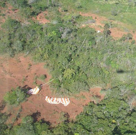
By using the valve and ballast, the balloon was forced after some while to descent to 2nd float level where it could sail back towards West. The third level was used to optimise the touch down point. The separation was commanded at 14:03 local time on June 15th, assuring that the touch down point was not far from a road to ease recovery. The last part of the descent could be watched by the helicopter.
Touch down was at ~ 14:41 local time in a place located NE of the city of Fortalezxa dos Nogueiras, in Maranhao state at coordinates ~ 6°47S, 46°W, about 400 km away from the launch site after a flight duration of almost 20 hours.
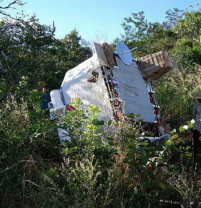
The gondola experienced a rather hard landing and was rapidly localised.
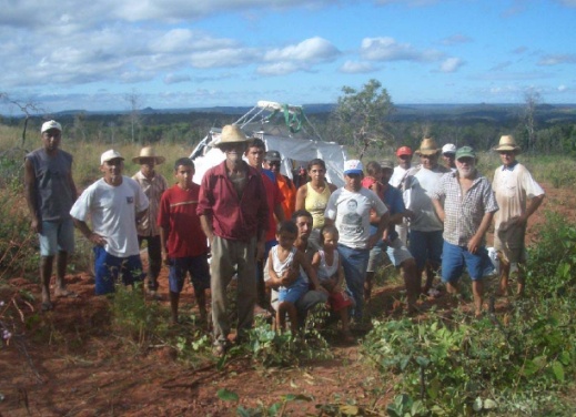
Of course, this event was the attraction for the locals (see pictures). After recovery and shipment back on about 700 km road the equipment returned to the site about 34 hours after touchdown.
(From the preliminary report of the MIPAS Team)
This was the flight # 15 of MIPAS-B2 and the first one to be carried out in the Tropics.
An UV photometer from IMK as well as, the mini-DOAS from University of Heidelberg and an ozone sonde were on board as piggy back instruments.
The measurement program was focussed to the validation of the Envisat instruments MIPAS and SCIAMACHY. In addition, were performed fast azimuth scans to obtain 3D surveys of the cloud tops, fine sampling of the Tropical Transition Layer (TTL) and the lowermost stratosphere, measurements of vertical profiles of short-lived species around sunrise with high temporal resolution as well as nadir measurements during ascent and descent for investigating the upwelling radiant fluxes in the Infrared.
The long flight duration allowed an almost perfect match of the evening overpass of Envisat.
All systems of the gondola worked absolutely stable and reliable most of the time. Checks during flight and afterwards have shown excellent performance of the spectrometer and the auxiliary systems.
External references
- MIPAS website Institut für Meteorologie und Klimaforschung - Universität Karlsruhe
- Balloons launched over Equatorial Brazil validate Envisat ESA website
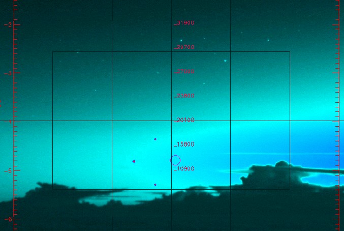
Images of the mission
If you consider this website interesting or useful, you can help me to keep it up and running with a small donation to cover the operational costs. Just the equivalent of the price of a cup of coffee helps a lot.
