Purpose of the flight and payload description
This gondola was created to be used exclusivelly for long duration missions onboard MIR or superpressure balloons.
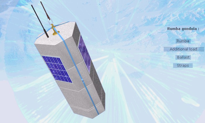
It consists of several sensors to obtain in-situ measurements of atmospheric parameters as pression, temperature and wind speed, coupled with a communication system wich transmits the data obtained to ground via the ARGOS satellite system and a GPS transmiter to obtain accurate position and height data. This elements are encased in a temperature insulated box of prismatic shape similar to the one pictured in the left image (click to enlarge). On top of it are located the ARGOS antenna and in the sides several solar panels that provide power to the onboard batteries.
In the lower part of the gondola is located a ballast system based on liquid nitrogen to control the speed of the balloon in the ascent phase.
Tha absolute pressure values are transmited to ground each minute, and the rest of the data four times each hour. The onboard electronics drives all the communication functions as well a backup flight termination device.
The actual RUMBA gondola is derived from an earlier version, but suffered a great simplification in their assembly and the correction of several design flaws troughout an extensive flight validation program.
Details of the balloon flight
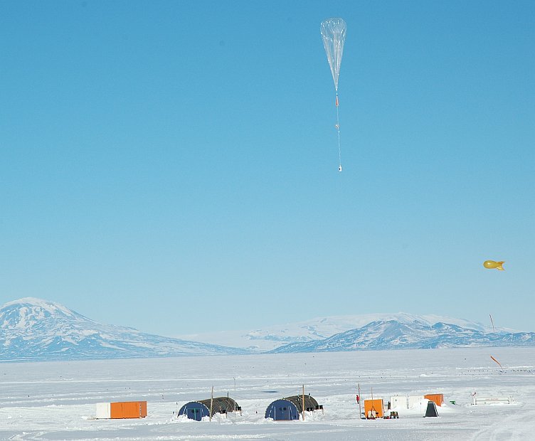
Balloon launched on: 10/26/2005
Launch site: Williams Field, McMurdo Station, Antarctica
Balloon launched by: Centre National d'Etudes Spatiales (CNES)
Balloon manufacturer/size/composition: Super Pressure Balloon 10 mts
Flight identification number: SV-26-H
End of flight (L for landing time, W for last contact, otherwise termination time): 11/15/2005
Balloon flight duration (F: time at float only, otherwise total flight time in d:days / h:hours or m:minutes - ): 17 d
Landing site: On the Indian Ocean. Last known position: 39.40º S - 74.98º E
Overall weight: 47kg
The balloon was launched on October 28th, 2005 by hand launched method assisted by a special platform developed for this kind of balloons.
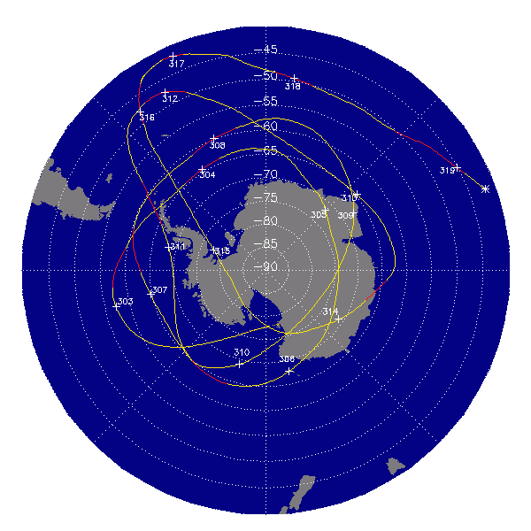
After a flight of 66 days -as can be seen in the map at left (click to enlarge)- the balloon ended his journey on November 15th, due to his path crossed the flight domain limit established at 40º latitude south.
The last known position was over the Indian Ocean at coordinates 39.40º S - 74.98º E
This flight was performed on the framework of the Stratéole/Vorcore campaign, aimed at studying the dynamics and transport inside the southern-hemisphere stratospheric polar vortex.
External references
- Stratéole/Vorcore campaign Laboratoire de Météorologie Dynamique web site
- Quasi-Lagrangian superpressure balloon measurements of gravity-wave momentum fluxes in the polar stratosphere of both hemispheres Geophys. Res. Lett., 34, L19804,
- Stratéole/Vorcore --- Long-duration, superpressure balloons to study the Antarctic lower stratosphere during the 2005 winter J.Atmos. Ocean. Technol., 24, 2048-2061, 2007
Images of the mission
If you consider this website interesting or useful, you can help me to keep it up and running with a small donation to cover the operational costs. Just the equivalent of the price of a cup of coffee helps a lot.
