Purpose of the flight and payload description
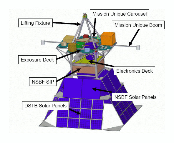
Is an exposure platform containing test materials supplied by various research groups.
The multi-instrument platform aim is to provide direct exposure to the interplanetary Galactic Cosmic Ray Composition and full energy spectra, to enable experimental validation of NASAs radiation transport codes used to protect astronauts from space radiation, to test the radiation shielding effectiveness of typical as well as novel spacecraft construction materials and to develope and test new radiation monitoring instrumentation.
Also this flight was the engineering proof-of concept flight to validate the DSTB gondola engineering design and NSBF systems interface for future Antarctic flights.
Details of the balloon flight
Balloon launched on: 6/18/2005 at 10:45 cdt
Launch site: Scientific Flight Balloon Facility, Fort Sumner, (NM), US
Balloon launched by: National Scientific Balloon Facility (NSBF)
Balloon manufacturer/size/composition: Zero Pressure Balloon Raven 28.400.000 - 0.8 Mil.
Balloon serial number: R 28.40-3-121
Flight identification number: 546N
End of flight (L for landing time, W for last contact, otherwise termination time): 5/18/2005 at 19:45 CDT
Balloon flight duration (F: time at float only, otherwise total flight time in d:days / h:hours or m:minutes - ): 9 h 53 m
Landing site: In a national forest 13 miles south southwest of Reserve, NM, USA
Payload weight: 2695 lbs
Overall weight: 4018 lbs
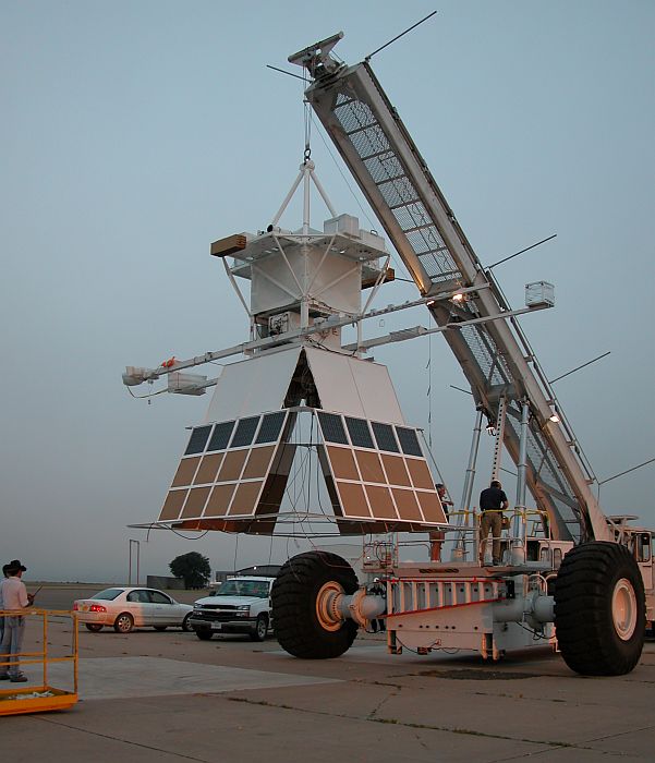
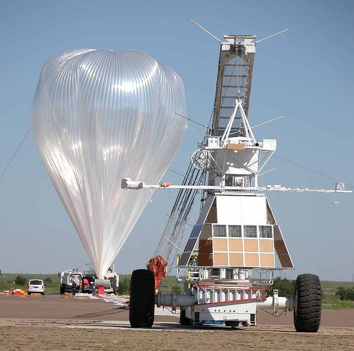
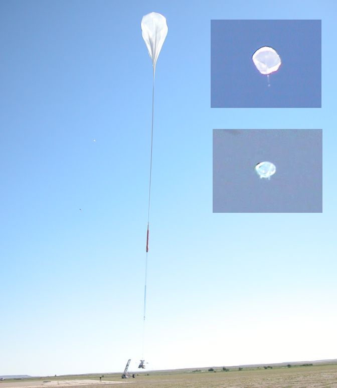
The balloon was successfully launched by dynamic method (Big Bill launch vehicle) at 10:45 a.m. CDT following numerous delays since mid-May due to weather, primarily high winds.
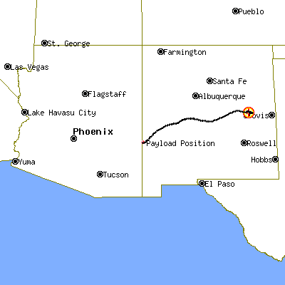
After a initial ascent phase, the balloon achieved float altitude of 125,000 feet starting a fly path to the southwest of the state of New Mexico, crossing it (click the map at left to see the balloon route).
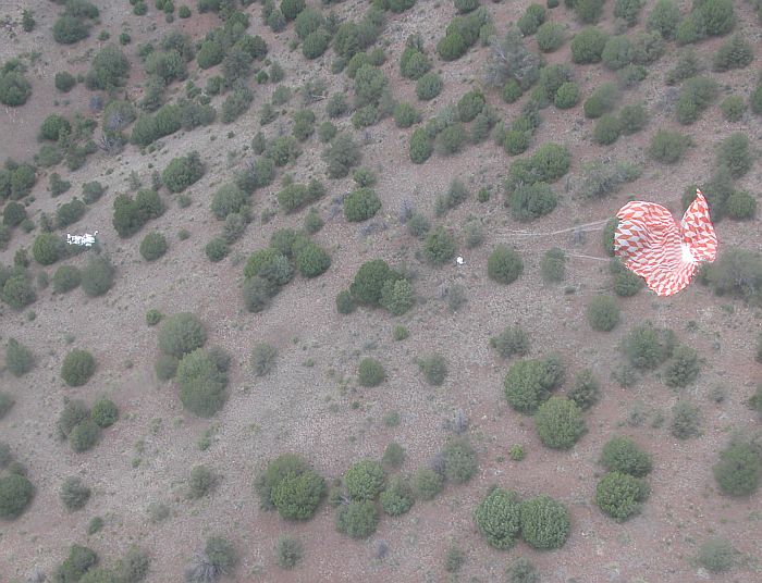
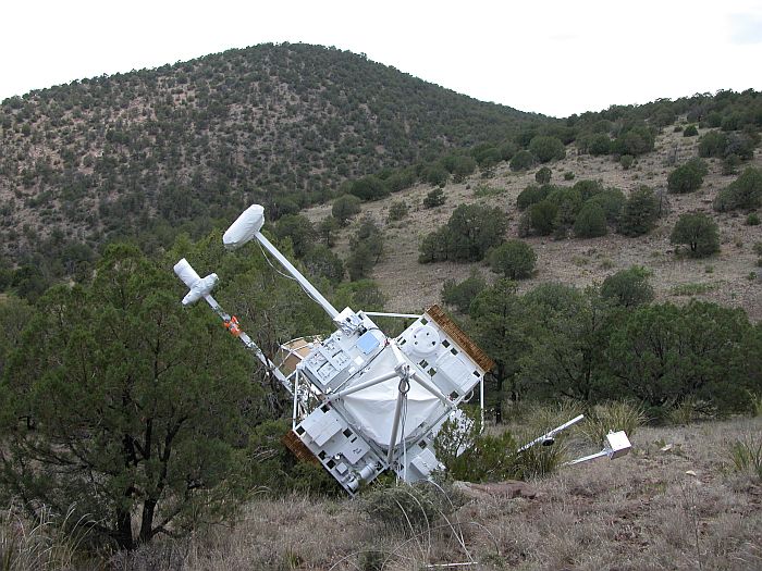
After near 10 hours of flight the separation command was sent at 19:45 CDT as planned and the payload landed at 20:38 CDT in a national forest 13 miles south southwest of Reserve, NM (33-31.1 N / 108-51.0 W).
The recovery team arrived to the landing site and with help of a helicopter wich transported the payload from the mountain slope in wich landed to a near road from where the NSBF truck transported it back to Fort Sumner.
External references
- Deep Space Test Bed website Marshall Space Flight Center, NASA
- Deep Space Test Bed - Sub-orbital Facility for Multiple Payloads on Stratospheric Balloon Flights University of Alabama website
- NASA, Student Researchers Launch High-Flying Lab Experiments NASA press release
- NASA, student researchers launch lab experiments Penn State LIVE
- NASA, Universities Partner to Fly Student Experiments Aboard High-Altitude 'Research Lab' in Early May NASA press release
- Students' payload to help NASA test high-altitude 'research lab' Penn State LIVE
- The Venture Crew Experiment on the 2005 Deep Space Test Bed High Altitude Balloon Flight The INSPIRE Journal - Volume 14 Number 1 - 2005
Images of the mission
If you consider this website interesting or useful, you can help me to keep it up and running with a small donation to cover the operational costs. Just the equivalent of the price of a cup of coffee helps a lot.
